
Land at Old Banwell Road, Locking
and Banwell Road, Elborough
A Country Park
The land in-between the two developments would be retained as open space. The intention is to turn this land into a publicly accessible country park, maintaining the gap between Locking and Elborough in perpetuity.

A plan showing the proposed country park in-between the two developments
The country park has been designed to incorporate the site’s existing green infrastructure (the network of hedgerows, the Site of Nature Conservation Interest and adjacent grassland) and the site’s blue infrastructure (the Hutton & Locking Rhyne, the wet and dry ditches and flood zones) into a large area of public open space. These existing features would be enhanced with new tree, grassland and wetland planting (including a proposed orchard and wildflower meadow) and with new landscaped attenuation features as part of the sustainable drainage strategy.
The country park would be open to the public at all times, with footpaths and cycleways across the central section providing new north-south routes between Locking and Elborough as well as east-west ones. The existing Public Right of Way to the west would also be retained to its original route. No vehicle links would be provided between the two developments across the open space.
Additional measures are also proposed to ensure the protection of views from the Mendip Hills National Landscape to the south. This includes retaining and where possible enhancing the vegetation along the site’s northern boundary, as well as ensuring that the proposed development on the land south of Old Banwell Road, Locking does not break the skyline through a small setback from the road.
Two children’s play areas are also proposed: one on the northern edge of the proposed Elborough development, and one on the southern edge opposite Elborough Farm.
Sustainable Drainage
Surface water run-off from the two developments would be managed using sustainable drainage measures (SuDS), designed in accordance with current best practice and provided within the areas of open space.
The preliminary drainage strategy proposes that surface water run-off from the developments would be collected in a series of new ponds and swales across the site, and then discharged into the Rhyne and the existing wet ditches at a rate equivalent to the existing rate for the undeveloped site. There would be no increase in flooding anywhere beyond the site.
The ponds and swales would be designed to accommodate a 1-in-100-year storm event and allow for a 45% increase in peak rainfall to account for the impact of climate change. Where space precludes the use of swales, attenuation storage for surface water will be provided by permeable paving overlying a porous sub-base stone.
A permanent wetland area is proposed within the north-western attenuation area, delivering long-term benefits for local flora and fauna.
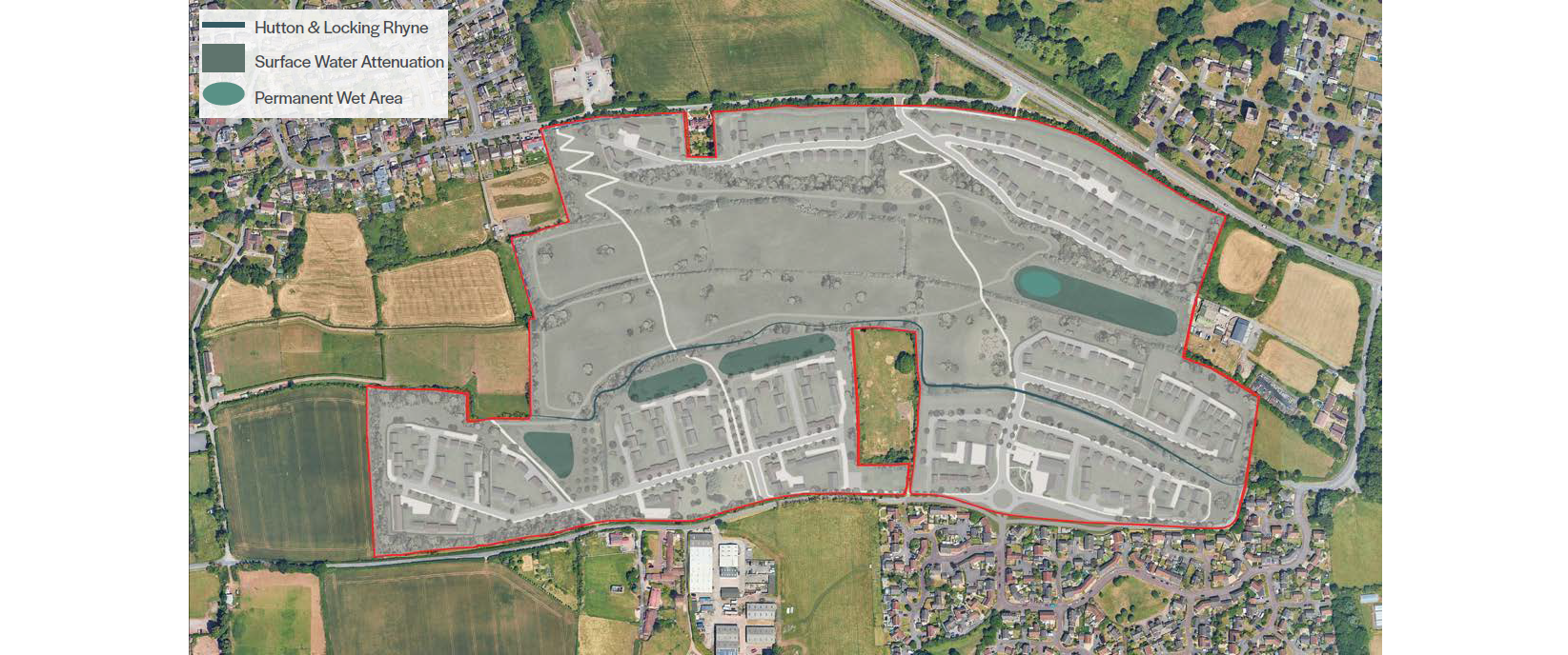
The proposed drainage strategy of ponds and swales to collect surface water
Contact Us
If you have any queries, please contact Jamie O’Sullivan of SP Broadway on 07706 274637 or at jamie@spbroadway.com